BMSP Trail Work Info (Last Modified: 04/17/2005)
The Blue Mound State Park single track trail around the mound was completed April, 10, and a phase II is just beginning. The work just completed accommodates both expert and beginner riders by giving beginners or intermediate riders easier options going between the camp ground and pool while leaving rocks present for experts. I have been told there are 8-9 miles of single track riding now, but I do not have a cycle computer to verify that information. If this is accurate you can consider our work about half done. The new phase of work is another extensive trail network centered in the Pleasure Valley portion of the park, and permission to build a boulder field down hill area in the mound section of the park.
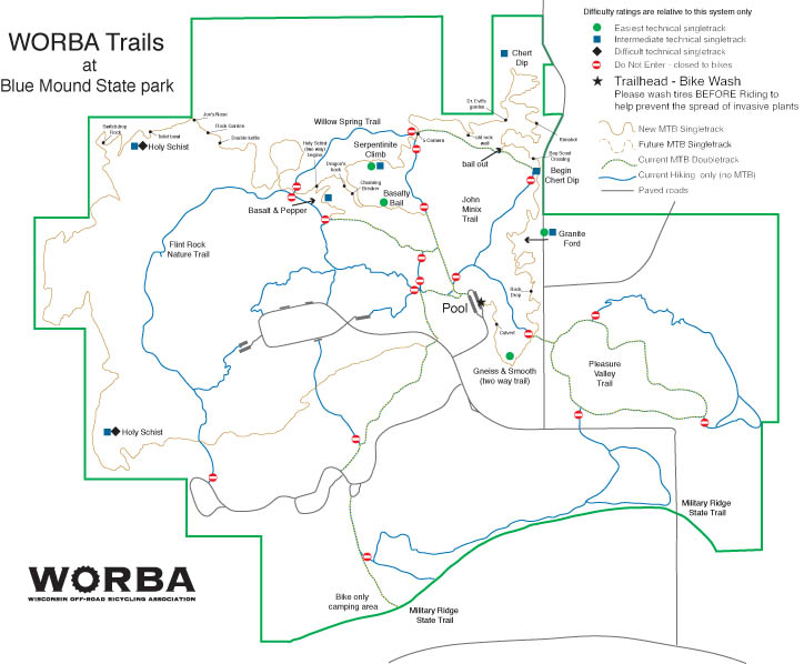
New Trail Map
Link to trail map newer than any printed at park or currently on WORBA web site: New Trail Map
New trail progress will depend entirely upon volunteer efforts. Whether we begin the boulder field down hill or Pleasure Valley first will depend on the help we get from the Mad Town Quarrlers group and/or other groups interested in down hill and trials type riding. This decision has been made because the park master plan calls for Blue Mound State Park to become a destination site where riders will have 15 miles or more of single track trail, the camp ground, swimming pool and connection to the Military Ridge Trail.
We are also planning improvements to the race course this year. Garett Kipp is the new race director. His contact information is listed below.
Volunteer work days are posted on the WORBA calendar. See www.worba.org. Walter and I also spend time working that is not on the official calendar, and work with groups and individuals to lead volunteer work days that are not on the official calendar. We also appreciate getting suggestions and concerns from trail users and WORBA sponsors. Our contact info:
WORBA BMSP Volunteer Trail Managers (spelled to reduce SPAM):
If you look at these maps I think you can see how the work already done at Blue Mound is just a portion of what can be built in the park, and that it will be the sort of area people plan their recreation time around. We hope all aware and interested in this project will promote volunteerism and donations so we may complete it while it remains in the park master plan.
Click thumbnail to enlarge, usage back arrow to return to page.
Trail Network - April, 2005:
Notes: This map shows the single track that is done and not yet on the state park brochure. Where and now this will be a destination site should be more obvious if you look at the park boarders relative to the current single track trail.
Aerial Photo of whole park:
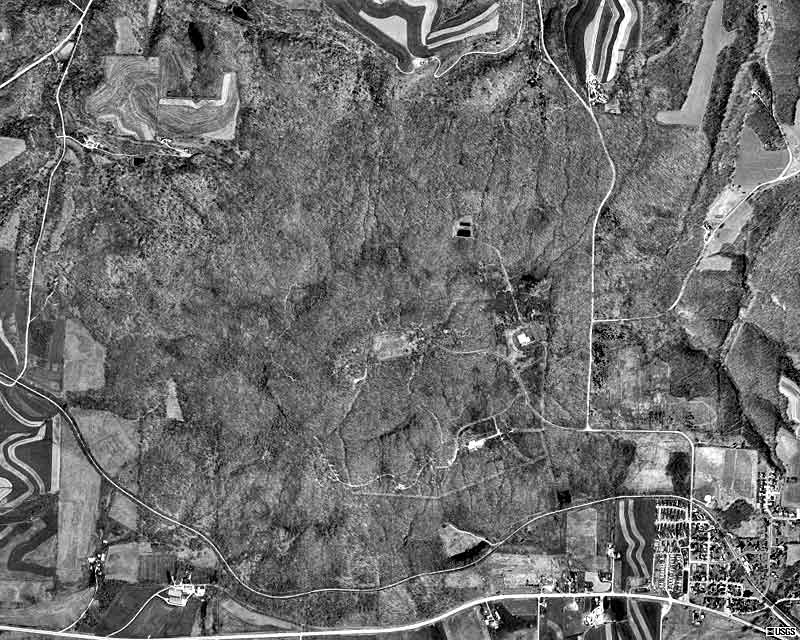
Notes: This photograph shows the whole park and illustrates the Pleasure Valley terrain that is much different than the rest of the park. The master plan calls for trail extending into the woods right next to town and between the camp ground and Military Ridge Trail.
Topographic Map of Park:
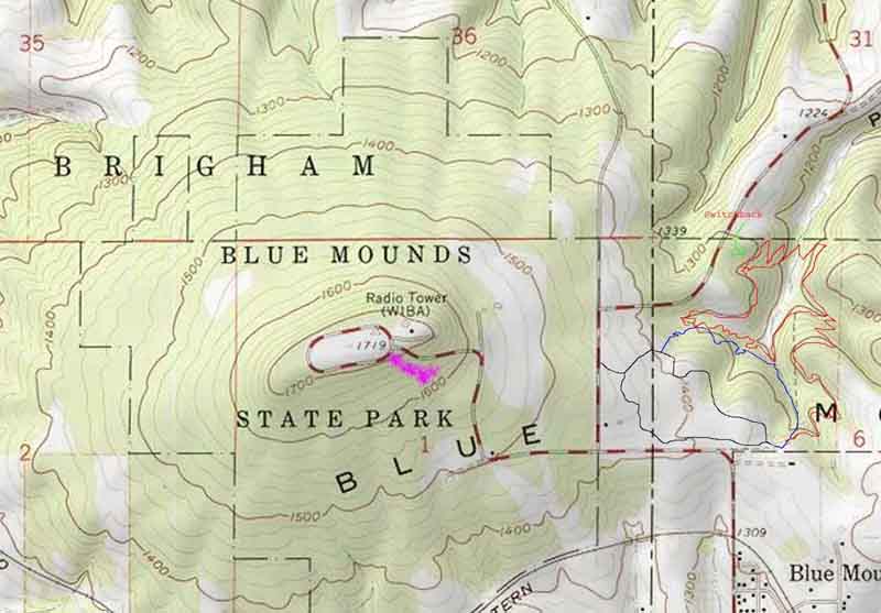
Notes: The area to the east with red markings is the Pleasure Valley section of the park where a new system of trails will be built. The park manager has allowed us to use the area between roads since this was drawn. This area is conducive to fast and swooping bench cut rails built near the contours, and steep expert riding in the many glens and stream crossings. The master plan calls for trails going all the way to the woods right next to town as well as south of any existing trail toward the Millitary Ridge Bike Trail. The number "18 miles" was mentioned in the original master planning.
The area marked in fuchsia is approximately where the "boulder field down hill" can be.
Please click here for page 2 (photos and more maps).